Understanding WAAS
Understanding WAAS
Wide Area Augmentation System, commonly known as WAAS, is a system designed to enhance the Global Positioning System (GPS). The primary purpose of WAAS is to improve the accuracy, integrity, and availability of GPS signals to benefit a wide range of users.

How WAAS Works
WAAS consists of a network of ground reference stations, master stations, uplink stations, and geostationary satellites. These components work together to monitor GPS satellite data and transmit correction signals.
- Ground Reference Stations: Positioned across North America, these stations collect GPS data.
- Master Stations: Process the data from ground reference stations to compute correction messages.
- Uplink Stations: Send the correction messages to the geostationary satellites.
- Geostationary Satellites: Broadcast the correction messages to WAAS-enabled GPS receivers.
The correction messages adjust for certain errors, such as ionospheric delays and satellite orbit errors. This enhances the accuracy of GPS positions provided to users.
Benefits of WAAS
WAAS offers several key advantages. Firstly, it provides highly accurate GPS positioning, reducing the margin of error to less than three meters. Secondly, it improves the integrity of the GPS signal, which is crucial for safety-critical applications. Additionally, the system increases the availability of GPS services, ensuring reliable coverage even in challenging environments.
Applications of WAAS
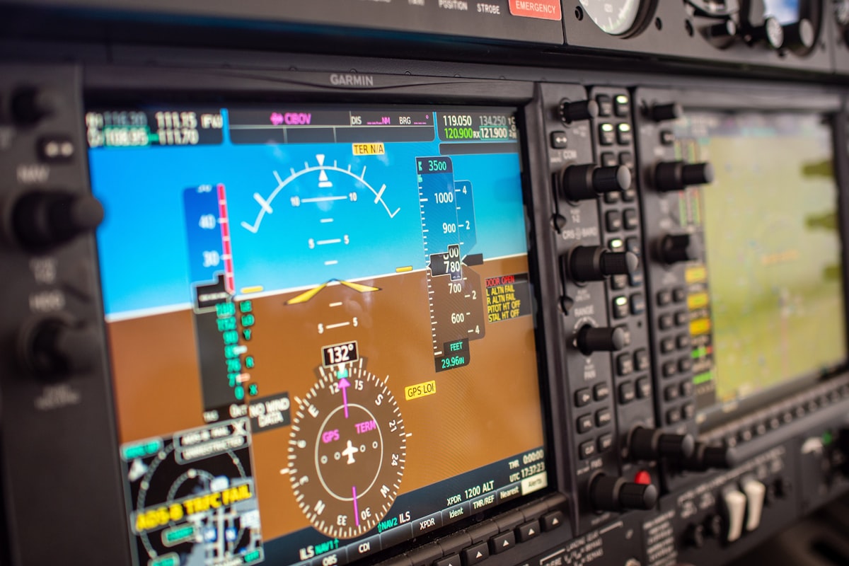
WAAS is widely used in various sectors. In aviation, WAAS enhances navigation and allows for more precise landing approaches. Pilots rely on WAAS for increased safety and efficiency. In agriculture, WAAS enables precision farming techniques, such as yield monitoring and variable rate application of inputs. Surveyors and mapping professionals benefit from WAAS by achieving higher accuracy in their measurements. The system also supports maritime navigation and emergency response operations.
WAAS vs. Other Augmentation Systems
WAAS is one of several Satellite-Based Augmentation Systems (SBAS) around the world. Other examples include EGNOS (European Geostationary Navigation Overlay Service) in Europe and MSAS (Multi-functional Satellite Augmentation System) in Japan. While these systems serve similar purposes, WAAS is specific to North America. Each system is designed to complement the regional GPS infrastructure, providing localized correction signals.
WAAS Coverage and Accessibility
WAAS coverage extends across North America, including the United States, Canada, and Mexico. The system is free to use for anyone with a WAAS-enabled GPS receiver. This accessibility allows diverse industries and individual users to benefit from the improved GPS accuracy and reliability that WAAS offers.
Technological Advances and Future of WAAS
Technological advancements continue to enhance WAAS capabilities. Updates to the system’s infrastructure and software ensure ongoing improvements in performance. Future developments may include expanding coverage areas and integrating with next-generation GPS satellites. These enhancements will further solidify WAAS as a critical component of the global navigation satellite system.
Challenges and Limitations
Despite its many benefits, WAAS faces certain challenges and limitations. One challenge is maintaining the infrastructure necessary to support the system. Continuous monitoring and maintenance of ground stations, satellites, and other components are required. Additionally, while WAAS significantly improves GPS accuracy, external factors such as signal obstruction and interference can still impact performance. Users in heavily forested or urban areas may experience reduced accuracy due to these factors.
WAAS in Everyday Life
WAAS has become an integral part of everyday life, influencing various activities and professions. For outdoor enthusiasts and hikers, WAAS-enabled GPS devices provide reliable navigation in remote areas. Geocachers use WAAS to enhance the precision of their treasure hunts. In the transportation sector, WAAS supports fleet management systems by enabling accurate vehicle tracking. The system also plays a role in location-based services, such as delivering personalized content based on a user’s precise location.
Educational and Research Implications
WAAS has significant implications for education and research. Students learning about GPS technology can benefit from understanding how WAAS enhances positioning accuracy. Researchers in fields such as geophysics and meteorology use WAAS data to study various phenomena, including tectonic movements and atmospheric conditions. The system’s ability to provide precise and reliable position information is invaluable for scientific investigations.
Implementing WAAS Technology
WAAS-enabled GPS receivers are essential for harnessing the benefits of the system. Most modern GPS devices, including those in smartphones and dedicated navigation systems, are WAAS-compatible. Installing and configuring these devices is straightforward, allowing users to take advantage of the enhanced accuracy without requiring extensive technical knowledge. For specific applications, such as aviation or surveying, specialized equipment and software may be necessary to fully utilize WAAS capabilities.
WAAS and Environmental Monitoring
Environmental monitoring is another area where WAAS makes a significant impact. Scientists and researchers use WAAS-enabled GPS devices to track wildlife movements, monitor changes in vegetation, and assess the impact of human activities on natural habitats. Precise location data provided by WAAS helps in creating detailed maps and models, which are critical for effective environmental management and conservation efforts.
WAAS and Emergency Services
Emergency services benefit greatly from WAAS technology. During search and rescue operations, WAAS-enabled GPS devices ensure accurate location tracking of both responders and victims. This improves coordination and increases the chances of successful rescues. In disaster response scenarios, WAAS supports the efficient deployment of resources and aids in the assessment of affected areas. The system’s high accuracy and reliability are vital for time-sensitive and life-saving operations.


